ZEPHEROS
ZEPHEROS
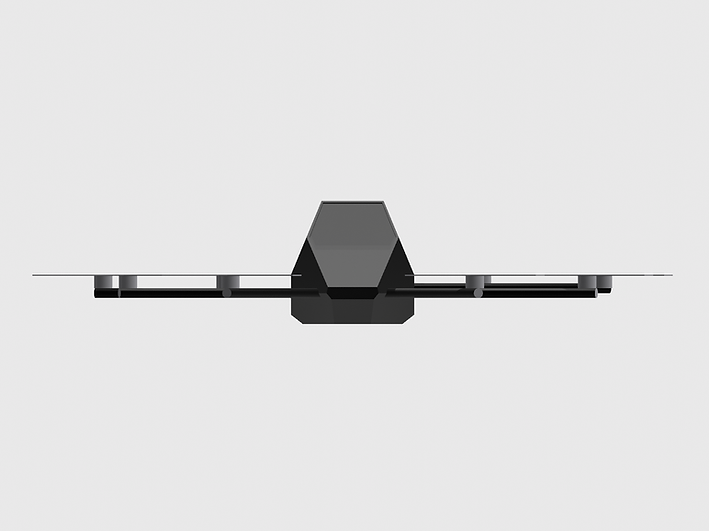
VANTA
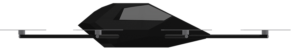
A personal electric aircraft, built for simplicity, safety, and real-world flight.
®

Tech-Focused
Zepheros’s VANTA will feature aerospace-grade carbon fiber construction, full sensor positioning along with and fully autonomous flight capabilities.
The electric VTOL is projected to reach speeds of up to 180 km/h with a maximum range of +150 km per charge, designed for a smooth, quiet, and comfortable ride
-
Tablet-controlled flight interface
-
8 Motors
-
Fully Autonomous
Built for simplicity, safety, and everyday use—VANTA redefines what personal air travel can be.


ABOUT ZEPHEROS
Why It Matters
The world is ready for a new layer of mobility. Roads are congested, infrastructure is aging, public transit is unreliable, and gas prices are increasingly unpredictable and costly.
Access to fast, flexible transportation remains limited, especially in rural, remote, and underserved regions. Not to mention the current price of eVTOL's in the market; let alone their size, making it extremely difficult for personal use.
By combining autonomous systems, electric propulsion, and a simple user interface, we aim to make personal flight accessible, and not just for the elite, but for commuters, emergency responders, rural workers, and everyday users.


Our Vision
Our vision is to unlock a new layer of mobility in the sky. We plan to make personal flight simple, safe, and more accessible to everyday people. Zepheros envisions a world where quiet, fully autonomous electric aircraft can take off from almost anywhere, giving people the freedom to move above traffic, beyond roads, and past the limits of conventional transportation.
What is PATH?
PATH is the next-generation flight-planning platform built for precision, safety, and clarity. Using Zepheros’s proprietary software and a sleek UI, PATH turns complex terrain and dynamic airspace data into an elegant 3D interface—so you can plot, optimize, and monitor every mission with absolute confidence.
Key Features
-
Immersive 3D Terrain Mapping
View photorealistic mountains, valleys, rivers, and man-made obstacles in a fully navigable holographic landscape. -
Dynamic Point-to-Point Routing
Arrange mission waypoints with a single click, then let PATH’s smart-routing engine arc each flight path to avoid crossings and potential conflicts. -
Real-Time Terrain UI
Experience a military-grade overlay of pins and arcing flight lines that updates live as conditions or parameters change. -
Auto-Optimized Collision Avoidance
Every route is calculated to guarantee that no two flight paths share the same airspace—ensuring safe, deconflicted operations at every altitude. -
Customizable Mission Parameters
Tailor altitude profiles, speed envelopes, and no-fly zones. Instantly visualize changes in your holographic display. -
Seamless Integration
Export clear, mission-ready flight plans in standard formats for any autopilot or fleet-management system—no extra conversions needed.
